
Aerial Surveyor for Coastal Property Planning
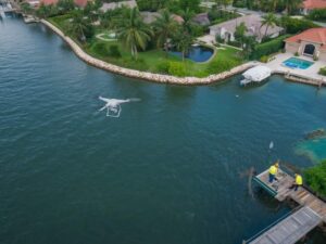
Coastal lots hide details a ground walk can’t catch. Wave patterns shift the shoreline. Vegetation grows thick along canal edges. An aerial surveyor can capture all of it in one flight, giving developers a clear picture before a single stake goes in the ground.
For anyone planning a build near the water here, that clear picture changes everything about how the project starts.
An aerial surveyor gives coastal developers a full view of shoreline conditions, vegetation, and access points before design work begins. Skipping this step often means costly surprises once construction starts.
Why Coastal Lots Need a Different Approach
A standard inland lot survey rarely accounts for tidal movement, erosion, or seasonal water changes. Coastal parcels in Hollywood deal with all three.
An aerial surveyor flies the full property in one pass. This captures the shoreline as it sits right now, not as it was described on an old plat from years back. Coastal edges shift. What was dry land a decade ago might be underwater today, and the reverse happens too.
What an Aerial Pass Actually Shows on a Coastal Lot
A flight over a waterfront parcel captures details that matter for planning.
This includes:
- Current shoreline position compared to the recorded property line
- Vegetation density along the water’s edge
- Erosion patterns visible from above
- Access points for docks, seawalls, or boat lifts
- Drainage flow toward the water during rain events
For a developer weighing where to place a structure, this data answers questions a ground walk simply cannot.
Spotting Erosion Before It Becomes a Problem
Erosion moves slowly, then all at once. A storm season can eat away several feet of shoreline that took years to erode gradually.
An aerial surveyor flying the same lot every year or two builds a record of change. Compare last year’s flight to this year’s and you can see exactly where the land is thinning out.
This matters most when:
- Planning a structure near the water’s edge
- Deciding where a seawall or bulkhead needs reinforcement
- Evaluating whether a lot has lost usable square footage since the last survey
Skipping this comparison means guessing at a problem that is easy to measure.
Checking Vegetation and Access Before You Design
Dense mangroves or overgrown brush along a canal can block access points that look fine on paper. An aerial image shows the real density, not what a site plan assumes.
For dock or seawall projects, this matters early. A design based on outdated vegetation data can miss a blocked access path or underestimate the clearing work needed before construction starts.
Ask your aerial surveyor to flag:
- Areas where vegetation blocks a planned access point
- Sections where clearing might affect drainage
- Any encroachment from vegetation onto a neighboring parcel
Using Aerial Data During the Planning Phase
Developers often order a boundary survey and stop there. On coastal lots, that’s not enough.
An aerial pass done early in the planning phase gives your design team:
- A visual reference for the whole parcel, not just measured points
- Shoreline condition data tied to a specific date
- A clear view of any existing structures near the water that might affect setback calculations
This data pairs well with a boundary survey rather than replacing it. Together, they give a fuller picture than either one alone.
Timing an Aerial Flight Around Weather and Tides
Coastal flights need the right conditions to be useful. Flying during low tide shows more shoreline. Flying after a storm shows fresh erosion patterns. Flying on a calm, clear day gives the sharpest images overall.
Ask your surveyor:
- Can you schedule the flight around low tide for a clearer shoreline view?
- Will you note the tide level and weather conditions on the report?
- Can a follow-up flight be scheduled after a major storm if needed?
A surveyor who tracks these details gives you data you can actually trust and compare later.
What Coastal Buyers Should Ask Before Closing
If you’re buying a waterfront lot for development, an aerial pass before closing can flag issues the listing never mentioned.
Ask for a report that includes:
- Current shoreline position versus the recorded boundary
- Any visible erosion or fill activity
- Vegetation density along the water’s edge
- Access conditions for future dock or seawall work
A buyer who orders this before closing has room to negotiate. A buyer who skips it finds out after the deal is done.
Building a Long-Term Record for Waterfront Property
Coastal land changes year over year. A single aerial survey gives you a snapshot. A repeated survey, done every year or two, gives you a record.
This record helps with:
- Tracking erosion trends over time
- Supporting insurance claims after storm damage
- Documenting site conditions before and after any construction phase
- Providing evidence if a boundary dispute comes up with a neighboring waterfront owner
A one-time flight tells you where things stand today. A repeated record tells you where things are headed.
Quick Checklist Before Hiring an Aerial Surveyor for a Coastal Lot
- Confirm they can schedule around tide levels
- Ask if they track shoreline change data over time
- Request vegetation and access notes, not just a raw image
- Ask how they handle post-storm follow-up flights
- Confirm the report format is something you can open and use right away
Frequently Asked Questions
How is an aerial surveyor different from a standard land surveyor for coastal lots?
A land surveyor establishes legal boundary lines through ground measurements. An aerial surveyor captures a full visual record from above, useful for tracking shoreline change, vegetation, and access conditions that ground measurements alone do not show.
Does tide level really affect the usefulness of an aerial survey?
Yes. Flying during low tide shows more of the exposed shoreline, giving a clearer picture of current land conditions compared to the recorded boundary.
How often should a waterfront property get a new aerial survey?
Many coastal developers order one every year or two, plus an extra flight after any major storm to document fresh erosion or damage.
Can aerial survey data help with a dock or seawall permit application?
Yes. Many permit applications benefit from current site images showing access points, vegetation, and shoreline conditions, though check with your local permitting office for specific requirements.
Is aerial surveying useful for buyers before closing on a coastal lot?
Yes. A pre-closing flight can reveal erosion, vegetation blocking access, or shoreline changes not mentioned in the listing, giving buyers room to negotiate or ask questions before finalizing the purchase.
For a free land surveying quote, call us at (954) 516-2680 or send us a message by going here.
Posted in land surveying, land surveyor | Tagged Aerial Surveying, Aerial Surveyor