
How Historical Deeds Affect Modern Boundary Surveys
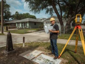 A property line is not always where the deed says it is. In Hollywood, Florida, where subdivisions date back to the 1920s land boom, old deeds carry gaps, errors, and vague descriptions that still cause headaches today. Boundary surveys are the tool that sorts out what the paper says versus what the ground actually shows.
For developers buying or building on older parcels, this history matters more than most people expect.
Old deeds often contain outdated language, missing corners, or conflicting descriptions. A current boundary survey resolves these gaps before you build, not after.
Why Old Paperwork Still Shapes New Construction
Hollywood’s original plats go back nearly a century. Many lots were platted, resold, split, and combined multiple times since then. Each transaction added a new deed. Few of those deeds matched perfectly with the one before it.
A modern boundary survey has to trace this whole chain. The surveyor is not just measuring your lot. They are checking how your deed lines up with the deeds around it.
What Makes Old Deeds Tricky to Work With
Deeds written decades ago often used descriptions that made sense at the time but confuse everyone now.
Common problems include:
- References to a tree, fence, or rock that no longer exists
- Distances measured in old units like chains or rods
- Descriptions tied to a road that has since been widened or moved
- Missing bearing angles that leave the shape of the lot unclear
A surveyor working in Hollywood has likely seen all four of these on the same parcel. Old plat books and county archives often hold the only clues to sort it out.
When Two Deeds Tell Two Different Stories
Sometimes a deed for your lot and the deed for the lot next door do not agree. Maybe both claim the same three feet of land. Maybe there’s a gap between the two that nobody owns on paper.
Surveyors call this an overlap or a gap, and both create real problems.
Resolving it takes:
- A review of both properties’ full deed history, not just the current owners
- Field measurements compared against the original plat
- Sometimes a review of aerial photos from decades back to see how the land was actually used
This kind of research takes time. Rushing it leads to bad assumptions that cause disputes later.
How Surveyors Trace a Deed Back Through Time
A surveyor does not start with your current deed and stop there. They work backward.
The process usually looks like this:
- Pull the current deed and note the legal description
- Trace back through prior deeds tied to the same parcel
- Check the original subdivision plat filed with the county
- Compare all of this against physical evidence found in the field, like old iron pins or concrete monuments
Each step either confirms the boundary or flags a conflict that needs more digging.
Physical Evidence Often Beats the Paper
Here’s something that surprises a lot of buyers. When paper and ground evidence disagree, courts and surveyors often lean toward what is physically there, not just what the deed says.
An old iron pipe set fifty years ago, still in the ground, can carry more weight than a distance written on a deed with a typo. This is part of why a licensed surveyor’s fieldwork matters so much. They are not just confirming numbers. They are hunting for the real evidence buried in the dirt.
Why This Matters More on Redevelopment Projects
Older neighborhoods in Hollywood are prime targets for redevelopment. Small older homes get torn down and replaced with larger builds. Lots get combined. Setbacks get pushed to the edge of what’s allowed.
On these projects, a boundary error of even one foot can force a redesign. If your new structure crosses a boundary that was drawn wrong from decades of accumulated deed errors, you may not find out until a neighbor complains or a permit inspector flags it.
A fresh boundary survey before design work begins catches this early, while it’s still just lines on paper instead of a built structure.
What Developers Should Ask Before Relying on an Old Survey
An old survey in the file does not mean the boundary is settled.
Before moving forward, ask:
- When was the last boundary survey done on this parcel?
- Did that survey trace the deed history back to the original plat?
- Are there any known conflicts with adjoining parcels?
- Have any adjoining lots been surveyed more recently, and do the boundaries agree?
If the answers are unclear, order a new survey before finalizing your site plan.
Red Flags That Signal a Deed Problem
Watch for these signs that a property’s deed history might cause trouble:
- The legal description uses units like chains, rods, or links
- The deed references a landmark that no longer exists
- Neighboring lots were platted at different times under different rules
- The lot has been split or combined more than once in county records
Any of these should push you toward a full boundary survey rather than trusting the file as it sits.
Frequently Asked Questions
Why do old deeds cause boundary problems today?
Old deeds often used vague landmarks, outdated measurement units, or descriptions tied to features that no longer exist. This creates confusion when a modern surveyor tries to match the deed to the actual ground.
What happens when two neighboring deeds overlap?
A surveyor reviews both properties’ deed history and compares it to physical evidence in the field, like old markers or monuments. This often resolves the conflict, though in some cases it requires legal action between the property owners.
Does a physical marker in the ground matter more than the deed description?
Often yes. When paper descriptions and physical evidence disagree, surveyors and courts frequently give more weight to long-standing physical markers found in the field.
How far back does a surveyor need to trace a property’s deed history?
Usually back to the original subdivision plat. This gives the surveyor a clear starting point to compare every deed transaction that followed.
Should I get a new boundary survey before redeveloping an older lot?
Yes, especially in older neighborhoods where lots have changed hands many times. A fresh survey catches deed errors before they turn into a costly redesign or a dispute with a neighbor.
For a free land surveying quote, call us at (954) 516-2680 or send us a message by going here.
Posted in land surveying, land surveyor | Tagged Boundary Survey, Boundary Surveyor