
Licensed Land Surveyor vs. GPS Property Apps: Why Technology Isn’t Enough
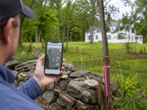
That App on Your Phone Is Not a Survey
Someone marks their property corners with a GPS app. It looks clean on the screen. They feel confident. Then a neighbor hires a licensed land surveyor. The lines don’t match. Now there’s a dispute, a delayed permit and a legal bill nobody planned for.
GPS property apps have a place. They’re fine for rough estimates and general orientation. But developers who use them as a substitute for a licensed survey are taking a real risk. The gap between what an app shows and what a survey legally establishes is wide.
What GPS Property Apps Actually Do
GPS apps pull data from public records and satellite positioning. They show property lines as stored in county databases or tax records. Some use your phone’s GPS to show your location relative to those lines.
That sounds useful. For casual reference, it can be.
The problem is the data these apps rely on. County records aren’t always current. Tax maps aren’t surveys. They’re administrative tools. They don’t account for physical monuments, legal descriptions or title history.
Where the Data Comes From
Most GPS property apps use one of these sources:
- County parcel data (tax maps)
- GIS (Geographic Information System) layers
- Satellite imagery overlays
None of those are legal surveys. They’re reference tools. A county parcel map can be off by several feet or more. On a tight urban lot, that’s the difference between your driveway and your neighbor’s.
What a Licensed Land Surveyor Actually Does
A licensed land surveyor doesn’t just look at a map. They go to the property. They research the title history, deed records and prior surveys. They locate physical monuments, set new ones and calculate exact boundary positions.
That process follows strict state standards. The surveyor stamps the result with their license. That stamp makes it legally binding.
The Legal Weight of a Stamped Survey
An app has no legal standing. A boundary dispute, a permit application, a title insurance claim. For anything that matters, you need a local survey company. No court will accept a screenshot from a GPS app as proof of a property line.
That distinction matters more for developers than for homeowners. Projects with permits, financing and contractors attached to them can’t afford to be built on guessed lines.
Where GPS Apps Fall Short for Developers
Developers face specific situations where app-based data creates real problems.
Permit Applications
Local building departments require surveys for most development permits. They don’t accept app data. The surveyor’s stamp is required. Submitting anything less will get your application rejected.
Boundary Disputes
If a neighbor challenges your property line, the dispute gets resolved with legal documents and field measurements. An app can’t defend a position in that process. A licensed surveyor can.
Easements and Encroachments
GPS apps don’t show easements. They don’t flag encroachments either. A building, fence or utility line that crosses a property boundary won’t show up as a problem on a consumer app. A licensed surveyor will catch it.
Lender and Title Requirements
Most lenders require a survey before closing on a development loan. Title insurance companies require it too. A phone app isn’t a substitute for either.
The Accuracy Problem
Consumer GPS, the kind in your phone or in most property apps, has an accuracy range of about 10 to 30 feet under normal conditions. Some newer phones get closer to 5 feet with a clear sky view.
A licensed land surveyor works to accuracy levels of hundredths of a foot. They use total stations, GPS receivers with real-time correction and field verification against known monuments.
On a 50-foot-wide lot, being off by 10 feet puts you on the wrong property.
When Technology Works With a Licensed Surveyor
Licensed land surveyors use technology too. High-grade GPS, drones and 3D scanning equipment are part of modern survey practice. The difference is that a licensed professional controls the equipment, interprets the results and takes legal responsibility for the output.
Technology is a tool. The license is what makes the result legally valid.
Frequently Asked Questions
Can I use a GPS property app to find my property lines?
You can use one to get a general idea. GPS apps aren’t accurate enough for construction, permits or legal disputes. For anything that matters, you need a licensed land surveyor.
Are GPS property apps ever accurate?
Consumer GPS has an accuracy range of about 10 to 30 feet. That’s fine for hiking. It’s not acceptable for marking a setback line or placing a foundation.
Does a GPS app hold up in a legal dispute?
No. Courts and local governments require surveys signed and stamped by a licensed land surveyor. App data has no legal standing in boundary disputes or permit reviews.
What does a licensed land surveyor use that an app doesn’t have?
Licensed surveyors use precision instruments, legal research and field verification. They locate physical monuments, review title history and produce legally binding documents. Apps do none of that.
When do I actually need a licensed land surveyor instead of an app?
Any time you’re pulling a permit, building near a property line, buying or selling land, or dealing with a neighbor dispute. If the result has legal or financial consequences, hire a surveyor.
For a free land surveying quote, call us at (954) 516-2680 or send us a message by going here.
Posted in land surveying, land surveyor |