
Why Waterfront Properties Often Require Additional Survey Research
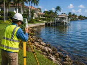
Waterfront land looks simple on a map, but it rarely is. A standard survey process usually stops at the property line. Waterfront parcels add layers most inland lots never touch.
This guide covers what makes waterfront survey research different, and why developers should budget extra time for it.
Why Water Changes the Rules
The Shoreline Is Not a Fixed Line
On an inland lot, boundary lines stay put. On waterfront land, the shoreline moves. Tides shift it daily. Storms shift it overnight. A surveyor working near water has to research how the boundary is legally defined, not just where the water sits on the day of the visit.
Ownership Near Water Follows Different Rules
Many states use special rules for land that touches water, often called riparian or littoral rights. These rules can affect who owns the land between the water and a fixed boundary line, and how much of that space an owner can build on or use.
Key Research Steps for Waterfront Parcels
Locating the Mean High Water Line
Many waterfront boundaries are tied to the mean high water line rather than a fixed marker. This line is calculated from tidal data over time, not measured in a single site visit. A surveyor often needs to pull tidal benchmark data from a government source before setting this line on a plat.
Reviewing Historic Deeds for Water Boundary Language
Older deeds near water sometimes describe boundaries in vague or outdated terms, such as referencing a creek bank that has since shifted. A surveyor has to research old deed language and compare it against current conditions to figure out where the legal line actually falls today.
Checking for Accretion and Erosion Changes
Land near water can grow or shrink over time as sediment builds up or washes away. This is called accretion and erosion. A surveyor researching a waterfront parcel has to check historical maps and aerial images to see if the land has changed since the last recorded survey.
Confirming Submerged Land Ownership
In many cases, land under the water near a shoreline is owned by the state, not the private property owner. A surveyor needs to research where private ownership stops and state-owned submerged land begins, especially if a dock or structure will extend over the water.
How This Affects Development Plans
Setback and Construction Line Research
Waterfront parcels often fall under coastal construction rules that set specific building lines closer to shore. A surveyor has to research which agency controls this line and confirm current setback distances before any site plan can move forward.
Permitting Overlaps With State and Federal Agencies
Unlike a typical inland lot, waterfront development often needs sign-off from more than one agency. A surveyor’s research can help identify which permits apply before you submit a site plan, which prevents delays later in the approval process.
Title Issues That Show Up Late Without Early Research
Some waterfront title issues, like a disputed accretion claim or an unclear submerged land boundary, only surface once a title company or buyer’s attorney digs deeper. Doing this survey research early, before a contract deadline, gives you time to resolve issues instead of scrambling at closing.
Questions to Ask a Surveyor Before Hiring for Waterfront Work
- Have they handled mean high water line research before?
- Do they know which state agency governs submerged land in this area?
- Can they research historical deed language for older waterfront parcels?
- Do they check for accretion or erosion changes using aerial history?
- Will they flag coastal construction control lines before you start design?
What This Means for Waterfront Development
Waterfront survey research takes more steps than a standard boundary survey. Tidal data, submerged land rules, and shifting shorelines all add layers that inland lots skip entirely. Budgeting extra time for this research upfront can prevent permit delays and title surprises later in a project.
Frequently Asked Questions
Why does a waterfront survey often cost more than a standard boundary survey?
Waterfront surveys require extra research steps, such as pulling tidal benchmark data and reviewing historic deed language. This added research time is usually the main reason waterfront surveys cost more than a typical inland boundary survey.
Can the shoreline on a waterfront property actually change the size of the lot over time?
Yes. Natural processes like accretion and erosion can add or remove land near the water. A surveyor researching a waterfront parcel checks for these changes because they can affect the legal size and boundary of the property.
Does a waterfront property owner always own the land under the water in front of it?
Not always. In many cases, submerged land near a shoreline belongs to the state rather than the private property owner. A surveyor needs to research where private ownership ends before any dock or structure is planned.
How does a mean high water line differ from a normal property boundary?
A mean high water line is calculated from tidal data collected over time, not from a fixed marker. This means the exact boundary can shift slightly as new tidal data becomes available, unlike a standard surveyed property line.
Do waterfront properties usually need approval from more than one government agency?
Yes, often. Waterfront development can require approval from state and federal agencies in addition to local permitting. A surveyor’s early research can help identify which agencies apply before a site plan moves forward.
For a free land surveying quote, call us at (954) 516-2680 or send us a message by going here.
Posted in land surveying, land surveyor | Tagged Land Surveying Services