
Boundary Survey Before Creating a New Shared Access Easement
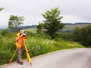
Setting up a shared access easement without a boundary survey is risky. You might get lucky. Or you might end up with a driveway that crosses the wrong lot. You could end up with an access path that fights with a neighbor’s fence for years. A boundary survey gives you real numbers before anyone signs anything. That way, the easement matches what’s really on the ground. Here’s what that process covers, and why each part matters.
How a Boundary Survey Finds the Limits of a Shared Access Easement
Before anyone can set up an easement, someone has to know exactly where the property lines are. A boundary survey finds those lines. It uses deeds, recorded plats, and other property records in the ground called monuments.
Once the lines are clear, the surveyor can point out the exact area where a shared access path could go. This gives everyone a real starting point. It’s much better than guessing based on where people already walk or drive.
This is not about repeating basic property-line facts. It’s about giving the new easement a strong base, one that holds up once it’s written into a legal paper.
Measuring the Width and Route for Shared Access
An easement needs more than a general direction. It needs exact numbers.
A survey shows how wide the access path should be. It shows the full length too, and which way it runs across the land. It also shows where the path connects to a road, a driveway, or another property. These connection points matter as much as the width. A path can look fine on paper, then run straight into a wall or a steep hill at one end.
Skipping this often leads to fuzzy wording in the easement papers. Fuzzy wording causes arguments later. A path with clear measurements, checked before any papers are written, cuts down on that risk.
Checking If the New Path Runs Into Other Things on the Land
A path can look wide open on a satellite photo. Then it runs straight into a problem once you’re standing on the land. Buildings, driveways, walls, wires, and drainage ditches can all sit right where a new path was planned.
A boundary survey records these things within the area being checked. This shows whether the new path will actually work, or whether it needs to shift a few feet. Maybe it needs to avoid a utility box. Maybe it needs to dodge a low spot that floods every spring.
This part is only about whether the path works in real life. It is not about digging into every hidden easement or every old problem on the land. Those are separate issues, checked another way. Here, the question is simple: will this one path do its job?
Writing a Clear Description of the New Easement Area
Once the path is checked and measured, that information has to turn into something a lawyer or title company can use.
A survey description lays out the exact size and location of the access area. It follows the form that legal papers require. This usually means a written description plus a drawing. The drawing shows the shape of the easement and where it sits next to the property lines.
Lawyers writing the easement papers use this description to get the wording right. Title companies use it to check that the easement is recorded the correct way. Property owners use it to know exactly what they agreed to. Without a clear survey description, all three groups are left guessing at facts that should have been settled from the start.
Why the Path Should Be Confirmed Before Papers Are Recorded
This is where many easements run into trouble. People talk about the route. They walk it once or twice. Everyone says it “looks right.” Then the papers get recorded based on that loose agreement, not on real survey facts.
A final check against the boundary survey fixes this gap. It should happen before anyone signs or records anything. This check confirms that the real path on the ground matches the description in the legal papers. If there’s a mismatch, even a small one, it’s much easier to fix before recording than after.
This is not about starting the plan over. It’s one last look, to make sure the path everyone agreed to is the same path becoming official.
Frequently Asked Questions
Does a new shared access easement need a boundary survey?
Yes, in most cases. A survey confirms the real property lines and the real path location. This stops confusion or fights once the easement gets recorded.
What does a surveyor need before locating a new access easement?
A surveyor usually needs the recorded deeds and existing plats. They also need access to the land, so they can find boundary markers and measure the proposed path.
How wide should a shared access easement be on a survey?
Width depends on how the easement will be used. A shared driveway needs a different width than a small utility path. The survey should show a clear, exact width, not a rough guess.
Can a new access path cross an existing driveway or utility area?
It can. But the survey should record any existing features first. This helps show whether the path needs to shift to avoid conflicts with what’s already there.
Can a boundary survey help write the legal description for a new access easement?
Yes. The measurements and boundary lines from the survey give the exact details needed to write a clear legal description for the easement papers.
For a free land surveying quote, call us at (954) 516-2680 or send us a message by going here.
Posted in Boundary survey | Tagged Boundary survey