
What a Licensed Surveyor Checks Before Certifying a Survey
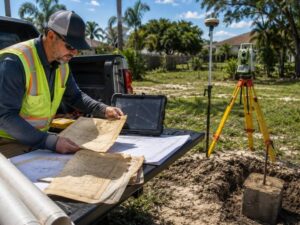
A survey certificate looks simple. A signature, a seal, a date. But before a licensed surveyor puts that seal on any survey document, a long checklist gets worked through. Developers who understand that process make better decisions about timing, costs and risk. Skipping steps in survey certification is how projects end up with title problems and failed inspections.
Verifying Property Records Before Fieldwork Begins
The field crew doesn’t leave the office until the records work is done.
A licensed surveyor pulls the recorded plat from Broward County before any equipment goes in the truck. They review the deed, check for recorded easements and look at prior surveys on file. If the property sits near a road, FDOT right-of-way maps get reviewed too.
This step catches problems early. A deed description that doesn’t close mathematically tells the surveyor there’s an error before anyone sets foot on the property. Finding that in the office takes an hour. Finding it in the field costs a day.
In Hollywood, many parcels carry easements recorded decades ago. Utility easements, drainage easements and access easements don’t always show up in online searches. The surveyor has to pull the actual recorded documents to know what’s there.
What the Records Search Covers
Before fieldwork starts, the records review includes:
- The recorded subdivision plat
- The current deed and prior deeds in the chain of title
- Recorded easements and restrictions on the parcel
- Adjoining survey records for neighboring parcels
- County and FDOT road right-of-way maps
If any documents conflict, the surveyor notes the problem before sending a crew to the site.
Recovering and Evaluating Existing Survey Monuments
Property corners are marked with physical monuments. Finding them is harder than it sounds.
In Hollywood’s older neighborhoods, original monuments from 1940s and 1950s plats are often buried under asphalt or gone entirely. A licensed surveyor knows where to look based on the plat geometry and the type of monument the original survey called for.
Iron pins, concrete monuments and aluminum caps each behave differently over time. Sandy soil shifts. Wet seasons move light monuments. A surveyor checks whether a found monument is still in its original position or has been disturbed.
A disturbed monument can’t be used as reliable evidence. Using a shifted iron pin to build a boundary from produces a wrong answer, even if every calculation after that point is correct.
Under Florida Administrative Code Chapter 5J-17, a licensed surveyor must document the condition of every monument found during the survey.
When Monuments Are Missing
Missing monuments get re-established by proportionate measurement. The surveyor calculates where the missing corner should be based on other corners that were found. That math has to be documented. A challenged boundary in Broward County court will look closely at exactly how the surveyor arrived at that position.
Comparing Field Measurements With Legal Descriptions
Field measurements have to match the legal description. When they don’t, the surveyor has to find out why.
A licensed surveyor measures distances and angles between corners. Those measurements get compared against the deed or plat. Common causes include:
- Accumulated errors in old plats that used chain measurements
- Road widenings that consumed parts of original lots
- Deed descriptions copied with errors through multiple title transfers
- Adjoining parcels re-surveyed at different times with different equipment
Each conflict has a different fix. A road widening requires checking FDOT records. A copied deed error means going further back in the title chain. A surveyor who just averages the gap and moves on is making a professional error.
Resolving Conflicts Before the Survey Is Certified
A licensed surveyor doesn’t certify a survey while known conflicts remain open.
Resolving a conflict may mean contacting the adjoining surveyor, requesting more title documents or pulling historical aerial photos. Some conflicts can’t be fixed through research alone.
When two valid recorded documents point to different boundary locations, the surveyor notes the conflict on the face of the survey. It gets flagged for the title company and the client. Certifying over an open conflict is a liability issue under Florida Statute 472.
Developers working on assembled parcels in Hollywood run into this often. When three or four lots get combined for one project, boundary conflicts between the original descriptions have to be resolved before the survey can be certified.
What Survey Certification Means for Property Owners
When a licensed surveyor signs and seals a survey, they’re making a legal statement.
The certification states that the survey meets the minimum standards set by Florida Administrative Code Chapter 5J-17 and that the information shown is accurate. That statement carries legal weight.
A certified survey can be used in court. It supports a title insurance policy. It meets Broward County’s requirements for building permits. Lenders accept it for construction loans.
For developers, that certification is only as good as the work behind it. A surveyor who skips the records check or certifies over unresolved conflicts produces a document that looks valid but carries hidden risk.
Asking a licensed surveyor to explain their process before hiring them is reasonable. Any surveyor worth hiring will walk through exactly what they check and why.
Frequently Asked Questions
What does survey certification mean legally?
Survey certification means the surveyor is confirming that the survey meets applicable Florida surveying standards. A certified survey can be used for permit applications, title insurance, and other legal or property-related purposes.
Why does records research happen before fieldwork?
Records research helps identify errors, missing easements, and potential boundary issues before the field survey begins. Resolving these issues during the research phase is typically faster and more cost-effective than discovering them after work starts on site.
What happens if a property monument is missing?
If a property monument is missing, the surveyor re-establishes the corner using accepted surveying methods and documented research. The procedures and supporting calculations are recorded as part of the survey process.
Can a survey be certified with unresolved conflicts?
No. Any known conflicts or discrepancies must be documented on the survey and disclosed to the client and any applicable parties before the survey can be certified.
How does certification affect a permit application?
Many permit applications require a certified survey to verify property boundaries and existing site conditions. An uncertified survey may not satisfy local permitting requirements, depending on the type of project and the jurisdiction.